3D ModelBETA Request access

Terrain, boreholes and roads in one 3D model

AC&P 3D MODEL opens drone point clouds, terrain surfaces, borehole logs and road alignments together, in real coordinates – on Windows, on a Mac, in the browser and in VR.

translateAvailable in English, Slovenščina, Français and العربية
AC&P 3D MODEL · D96/TM (EPSG:3794)
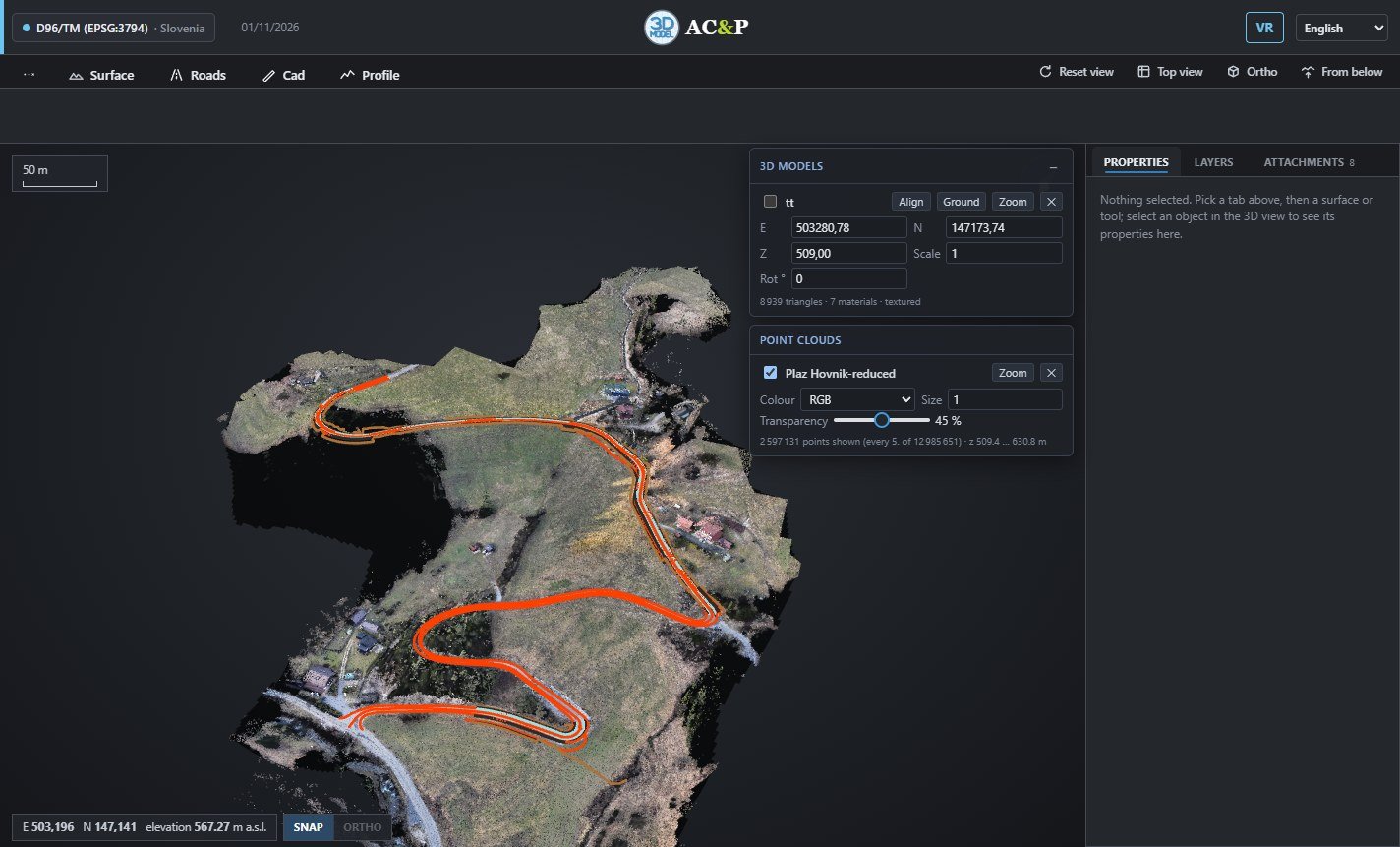
AC&P 3D MODEL showing a drone point cloud and a road design

Opens the files your survey team already has

Drop them on the window. Coordinates are read in D96/TM, UTM, the Tunisian Carthage systems and more.

LASLAZOBJ + MTLIFCDXF LandXMLGeoTIFFASCXYZCSV GeoPackageShapefileGeoJSONJPG / PNG + world
scatter_plot2.6 million points in view

Point clouds and terrain at full resolution

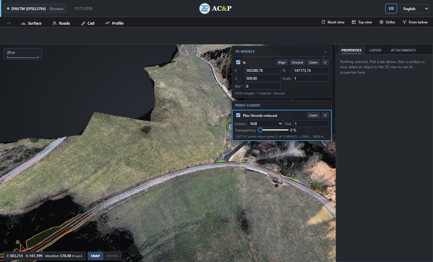
Millions of drone or laser points, coloured by RGB, elevation, intensity or classification. Drape an orthophoto on the terrain and switch between surfaces in one click.

  • check_circleLAS and LAZ point clouds
  • check_circleTerrain from GeoTIFF, ASC, XYZ or LandXML
  • check_circleOrthophotos with world file
Learn morearrow_forward

Boreholes and geology where they really are

Import investigation points from GeoPackage, Shapefile or GeoJSON. Lithology columns, groundwater and geological surfaces appear in 3D at their true depth.

  • check_circleLithology columns and legend
  • check_circleGroundwater level from the descriptions
  • check_circleGeological surfaces between boreholes and profiles
Learn morearrow_forward

Profiles and road alignments in minutes

Draw a profile across the terrain or a road on the map: every corner gets a smooth curve, with chainage, longitudinal profile and cut and fill volumes.

  • check_circleLongitudinal and cross sections
  • check_circleAutomatic curves with editable radius
  • check_circleCut and fill volumes
Learn morearrow_forward

CAD tools on the terrain

A BricsCAD-style command line: lines, polylines, offsets, trims, distances, areas and elevation labels, with snapping. Export your drawing as DXF.

  • check_circleSnap to points, ends and midpoints
  • check_circleMeasure distance, area and slope
  • check_circleExport to DXF
Learn morearrow_forward

Windows and Mac – and soon the browser and Android

The same viewer everywhere. Each copy is personal and protected by a signed licence.

Windows

Windows 10 and 11

Desktop program. Your copy is activated for your computer.

Learn more

macOS

Apple silicon and Intel

Native app for M-series and Intel Macs.

Learn more
Coming soon

Online

Chrome, Edge, Safari, Firefox

Nothing to install. Add it as an app and keep working without internet.

Coming soon
Coming soon

Android

Tablets and phones

For site visits, with the same projects.

Coming soon

Walk your project in virtual reality

Link a Meta Quest to the PC with Air Link or Quest Link. See the whole site as a model on a table, fly over it, or stand on the road at real scale.

table_restaurantModel on a table flightFly over the site directions_walkStand on the road at 1:1
Learn morearrow_forward

Your projects stay yours

lock_person

By invitation only

Nobody can sign up alone: AC&P gives each person their access, and can switch it off at any time.

verified_user

Signed licences

Every copy carries a licence signed by AC&P and activated for one computer. It cannot be edited or copied.

wifi_off

Works without internet

Work on site with no network: everything is saved on the computer and synchronised when the connection comes back.

How your data is protectedarrow_forward

Four languages, one switch

English by default, with Slovenian, French and Arabic one click away. The Arabic interface reads from right to left.

English
SurfaceRoadsProfile
Point clouds
Transparency
Slovenščina
PloskevCesteProfil
Oblaki točk
Prosojnost
Français
SurfaceRoutesProfil
Nuages de points
Transparence
العربية
السطحالطرقالمقطع
سحب النقاط
الشفافية

Get your copy of AC&P 3D MODEL

Tell us who you are and which computers you work on. Access is given by AC&P: you receive a personal copy for Windows or Mac, or a personal link to the web version.